↓
 

Trussville Land Surveying

Your First Choice for Surveying in Trussville, AL.....

Trussville Land Surveying
  • Home
  • ALTA Survey
  • Civil Engineering
  • Drone LiDAR Mapping
  • Elevation Certificate
  • Land Surveying
  • Property Surveying
  • Topographic Survey | Topo Survey
  • Contact Us
  • Blog
Home - Page 2 << 1 2

Post navigation

Newer posts →

How Much Does a Land Survey Actually Cost? Here’s What to Expect

Trussville Land Surveying Posted on June 5, 2026 by TrussvilleSurveyorJune 8, 2026
Property owner discussing land survey cost and survey requirements with a licensed survey professional

The price of a land survey depends almost entirely on what type you need. Ask for the wrong one and you might pay for something that doesn’t solve your problem. Ask for the right one without understanding the cost range and the quote might catch you off guard.

This page breaks down what each common survey type costs, what drives prices up, and what you can realistically expect to pay before you call anyone.

Why There Is No Single Answer to Survey Costs

Land surveys are not a standardized product. Every parcel is different. The size, shape, history, and condition of a property all affect how long the job takes, and time is the primary driver of cost.

A surveyor who gives you an accurate quote has usually reviewed your deed and public records before putting a number on the table. A quote given without that review is really just a rough estimate.

With that said, there are reasonable ranges for each survey type that give you a solid starting point.

Cost by Survey Type

Boundary Survey: $500 to $1,500

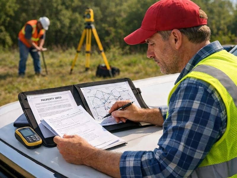
A boundary survey is the most common type for residential properties. It locates and confirms the legal corners and lines of a parcel.

The lower end of the range applies to small, simple lots with recent records and intact monuments. The upper end applies to larger lots, properties with older or unclear deeds, or parcels where prior monuments are missing.

ALTA Survey: $2,000 to $5,000 and up

An ALTA survey follows strict national standards and is most often required for commercial real estate transactions. It is significantly more detailed than a standard boundary survey, covering easements, encroachments, utilities, access points, and improvements.

The wider scope means more research, more field time, and more detailed documentation. Commercial properties with complex ownership histories or multiple easements sit at the higher end of the range. Straightforward commercial lots can come in closer to the lower end.

Topographic Survey: $1,000 to $3,000

A topographic survey maps elevation, slopes, drainage patterns, and physical features of a site. Engineers and architects use this data to design structures, grading plans, and drainage systems.

Cost depends heavily on the size of the area being mapped and the level of detail required. A small residential lot costs less than a large development site. Projects that require LiDAR-assisted mapping may cost more but can cover larger areas more efficiently than traditional ground methods.

As-Built Survey: $1,000 to $2,500

An as-built survey documents what was actually constructed on a property after work is complete. It verifies that the finished project matches the approved plans and meets permit requirements.

The cost varies based on the size and complexity of the structure. A single-family home costs less to document than a multi-building commercial project. Rush timelines, which are common when a lender or inspector is waiting on the results, typically add to the price.

Elevation Certificate: $400 to $900

An elevation certificate records the elevation of a structure relative to the base flood elevation for that area. It is used primarily for flood insurance purposes.

Most residential elevation certificates fall in the middle of this range. Properties that are difficult to access, require additional measurements, or involve complex site conditions push toward the higher end.

Plat Survey: $1,500 to $4,000

A plat survey creates a formal map of a parcel or subdivision that gets recorded with the county. It is typically required when subdividing land into new lots.

The range reflects the number of lots being created, the complexity of the legal description, and the local government’s specific requirements for recorded plats. Projects in jurisdictions with detailed submittal standards take longer to prepare and cost more.

What Can Push Any Survey Higher Than Expected

Regardless of survey type, a few factors consistently drive costs above the typical range.

Older properties with unclear records. When a deed is vague, references missing landmarks, or conflicts with neighboring descriptions, the surveyor has to spend significantly more time in both research and field work to resolve the ambiguity.

Rural or large acreage parcels. More ground to cover means more time. A ten-acre rural tract costs more to survey than a quarter-acre suburban lot, even for the same survey type.

Heavily wooded or difficult terrain. Dense vegetation and steep slopes slow field work and add time to the job.

Rush requests. Most surveyors can accommodate faster turnarounds, but expedited service typically carries an added fee. If your timeline is tight, ask about this upfront so the cost is built into your quote.

Multiple uses for one survey. Some clients need a survey that satisfies more than one requirement at once, such as a boundary survey that also meets lender specifications. Combining requirements can add scope and cost.

Does the Cheapest Quote Mean the Worst Quality?

Not always, but it is worth understanding why one quote comes in lower than others before you accept it. A lower price sometimes reflects a smaller firm with lower overhead, aggressive pricing to win business, or a surveyor who has reviewed your records and genuinely sees a straightforward job.

It can also reflect a quote given without a proper records review, a plan to cut field steps, or a lack of adequate insurance coverage. The finished survey is a legal document. If it contains an error, fixing it costs far more than the original price difference.

Two things worth confirming with any surveyor before signing: that they hold an active Professional Land Surveyor license in your state, and that they carry errors and omissions insurance.

A Note on Getting an Accurate Quote

The most reliable quotes come from surveyors who have reviewed your deed and any existing records before giving you a number. If a firm quotes you a firm price over the phone without asking for your property address or parcel number, treat that number as a rough estimate, not a commitment.

Providing your deed, any previous surveys, and your property’s legal description upfront gives the surveyor what they need to price the job accurately. It also tends to speed up the process once you hire them.

Frequently Asked Questions

Is the cost of a land survey tax deductible? 

In some situations, yes. Survey costs related to the purchase of investment or business property may be deductible as part of the property’s cost basis. For a primary residence, deductibility is more limited. A tax professional can advise on your specific situation.

Do survey costs vary by state? 

Yes, meaningfully. States with higher costs of living, stronger licensing requirements, or more complex recording systems tend to have higher average survey fees. Local market demand also plays a role. A surveyor in a busy urban market may charge more than one in a rural area simply because of workload and overhead.

Can I negotiate the price of a land survey? 

Negotiation is less common in surveying than in other professional services, because most of the cost reflects actual labor time. That said, if you have multiple properties that need surveys, or if you can offer flexibility on timeline, some surveyors will adjust their pricing. It is always reasonable to ask.

What is included in a survey quote, and what is not? 

Standard quotes typically cover research, field work, calculations, and the finished drawing. What varies is whether staking, recording fees, or expedited service are included. Always ask for an itemized breakdown so you know exactly what you are and are not getting.

How often do final survey costs differ from the original quote? 

On straightforward properties with clean records, the final cost usually matches the quote closely. On older or more complex parcels, a surveyor may encounter unexpected problems during research or field work that add time to the job. A good surveyor communicates this before proceeding, rather than surprising you with a larger bill at the end.

Posted in land surveying | Tagged land surveying

Why Does a Boundary Survey Cost So Much? 

Trussville Land Surveying Posted on June 3, 2026 by TrussvilleSurveyorJune 4, 2026
Surveyor reviewing property records and survey maps while a field crew performs boundary survey measurements

You asked for a quote on a boundary survey and the number came back higher than you expected. Maybe a lot higher. Before you start shopping for the cheapest option, it helps to understand what you’re actually paying for and why cutting corners on a survey is one of the riskier ways to save money on a property.

What Goes Into the Price of a Boundary Survey?

A boundary survey looks simple from the outside. Someone walks your property, takes some measurements, and hands you a map. But most of the work happens before and after the field visit, and that work takes time.

Here is what a licensed surveyor actually does when they take on a boundary survey job:

Research and records review. Before setting foot on your property, the surveyor pulls deed records, prior surveys, plat maps, and public land records going back as far as needed. On older or rural properties, this research alone can take several hours.

Field work. A survey crew visits the property to locate existing monuments, take measurements, and verify what the records say against what exists on the ground. If prior monuments are missing or conflicting, the crew has to work harder to reconstruct the boundary from other evidence.

Calculations and drafting. Back in the office, the surveyor runs the math, resolves any discrepancies in the data, and prepares a finished survey drawing that meets your state’s legal standards.

Licensing and liability. The surveyor stamps and signs the final document. That signature carries legal weight. If the survey is wrong, the surveyor is professionally and financially responsible. That accountability is built into the price.

What Makes One Survey Cost More Than Another?

Two properties in the same neighborhood can produce very different quotes. Here’s why:

Lot size and shape. Larger parcels with more corners take longer to measure. Irregularly shaped lots with many boundary segments cost more than a simple rectangle.

Terrain and access. A flat suburban lot with clear sight lines is faster to survey than a heavily wooded parcel on a slope. Dense vegetation, steep grades, and difficult access all add time in the field.

Record quality. If your property has a clean, recent survey on file and well-maintained monuments, the job goes faster. If the deed description is old, vague, or conflicts with neighboring deeds, the surveyor has to do more research and exercise more professional judgment to resolve it.

Number of adjoining properties. When your boundary shares lines with multiple neighbors, the surveyor has to consider each neighboring deed as part of the research. More neighbors means more records to review.

Location. Labor costs, licensing fees, and local market rates vary by state and region. A survey in a metro area often costs more than the same survey in a rural county nearby.

The National Average, and Why It Varies

The national average for a residential boundary survey runs between $500 and $1,500 for a standard lot. Larger or more complex properties can push the cost to $2,500 or higher. Rural acreage with old deeds and missing monuments can go higher still.

Those ranges are wide because no two parcels are alike. A quote higher than the average does not mean you’re being overcharged. It often means the surveyor has looked at your specific records and priced the actual work your property requires.

When a Lower Quote Should Give You Pause

Getting multiple quotes is a reasonable thing to do. But if one quote comes in significantly lower than the others, ask why before you accept it.

A lower price sometimes means a surveyor is hungry for work and pricing aggressively. That can be fine. But it can also mean they haven’t fully reviewed your records, they’re planning to skip steps, or they don’t carry adequate errors and omissions insurance.

A boundary survey produces a legal document. It may be used in a property transaction, a permit application, or a legal dispute. If it contains an error and the surveyor isn’t properly insured, the cost of fixing the problem lands on you.

Before hiring, ask any surveyor you’re considering:

  • Are you licensed in this state?
  • Do you carry errors and omissions insurance?
  • What does your quote include, specifically?
  • Have you reviewed my deed and existing records before quoting?

A surveyor who can answer all four questions clearly is worth paying for.

So When Is the Cost Actually Worth It?

Almost always, but the situations below are ones where skimping creates the most risk.

Before building a fence or structure. A fence installed even a foot over the line can result in a forced removal, a legal dispute with your neighbor, or both. The cost of a survey is small compared to the cost of tearing out a fence.

Before buying property. You’re making one of the largest financial decisions of your life. Knowing exactly what you’re buying, and that the boundary is where you think it is, is worth the investment.

When a neighbor dispute exists. If there’s any disagreement about where a line falls, a licensed survey is the only document with legal standing. An informal measurement or an old sketch won’t hold up.

When applying for a permit. Many local governments require a current survey before issuing a building permit. Getting one done properly from the start avoids delays later.

Posted in boundary surveying | Tagged boundary survey

Not All Land Surveys Are the Same. Here’s How to Know Which One You Need

Trussville Land Surveying Posted on June 1, 2026 by TrussvilleSurveyorJune 2, 2026
Surveyor using digital mapping technology to review land surveys for residential and commercial properties

Most people assume a land survey is a land survey. You call someone, they walk your property, and you get a map. Simple enough. But ask for the wrong type and you could end up paying for something your lender, your contractor, or your title company won’t accept.

There are several types of land surveys, and each one is built for a specific purpose. Knowing the difference before you hire saves you time, money, and a lot of back-and-forth.

What Is a Land Survey, Exactly?

A land survey is a professional measurement of a property’s boundaries, features, and physical conditions. A licensed land surveyor uses field equipment, legal records, and established methods to produce a document that’s legally recognized. Most real estate transactions, construction projects, and permit applications require one before any work begins.

The type of survey you need depends entirely on what you’re trying to do with the property.

What Are the Different Types of Land Surveys?

The most common types are boundary surveys, ALTA surveys, topographic surveys, as-built surveys, elevation certificates, and plat surveys. Each one measures something different and serves a different situation.

Boundary Survey

A boundary survey locates and confirms the legal corners and lines of a property. It’s the go-to survey for most homeowners.

What it’s used for:

  • Resolving a dispute with a neighbor
  • Installing a fence on the correct line
  • Buying or selling residential property

Typical cost: $500 to $1,500 for a standard residential lot, depending on size and location.

ALTA Survey

An ALTA survey follows strict national standards set jointly by the American Land Title Association (ALTA) and the National Society of Professional Surveyors (NSPS). These standards are updated every five years to reflect changes in property law and industry practice.

What it’s used for:

  • Commercial real estate transactions
  • Lenders and title companies requiring a higher level of detail
  • Properties with complex easements, encroachments, or improvements

An ALTA survey goes well beyond a basic boundary survey. It documents utilities, improvements, encroachments, access points, and much more. If a lender or title company has asked for one by name, you need this specific type, not a general property survey.

Topographic Survey

A topographic survey maps the elevation and physical features of land. It shows slopes, drainage patterns, trees, structures, and contour lines.

What it’s used for:

  • Planning a construction or grading project
  • Designing drainage or stormwater systems
  • Landscaping or site development

Engineers and architects use topographic data to design structures that fit the natural lay of the land. Without it, a project can run into serious drainage or grading problems after construction starts.

As-Built Survey

An as-built survey documents what was actually constructed on a property after work is complete. It compares the finished structure to the original approved plans.

What it’s used for:

  • Confirming that a building was constructed as permitted
  • Closing out a construction loan
  • Satisfying a local permit or inspection requirement

Lenders and local governments often require an as-built survey before they release final funds or issue a certificate of occupancy.

Elevation Certificate

An elevation certificate is a form completed by a licensed surveyor that documents the elevation of a structure relative to the base flood elevation in that area.

What it’s used for:

  • Applying for or renewing flood insurance through the National Flood Insurance Program (NFIP)
  • Appealing a FEMA flood zone designation
  • Determining accurate flood insurance premiums

A lower elevation relative to the flood zone can mean higher premiums. In some cases, an elevation certificate can demonstrate that a property is actually at lower risk than FEMA’s map suggests, which can reduce insurance costs significantly.

Plat Survey

A plat survey creates a formal map of a parcel or subdivision that gets recorded with the county. It shows lot lines, dimensions, easements, rights-of-way, and other legal details.

What it’s used for:

  • Subdividing land into multiple parcels
  • Creating a new subdivision for development
  • Recording a formal legal description of a newly divided tract

If you’re splitting a single parcel into two or more lots, a plat survey is typically required by the local government before any lot can be legally sold or built on.

How Do You Know Which One You Need?

Here’s a simple way to think about it:

  • Buying or selling a home? A boundary survey confirms what you’re actually purchasing.
  • Lender or title company involved in a commercial deal? Ask specifically if they require an ALTA survey.
  • Planning to build, grade, or install drainage? Order a topographic survey first.
  • Project just finished? An as-built survey documents what was built.
  • In or near a flood zone? An elevation certificate may lower your insurance rate.
  • Splitting land into new lots? A plat survey is what gets recorded with the county.

When you’re not sure, describe your project to a licensed land surveyor and ask which type applies. That conversation is usually free, and it saves you from ordering the wrong thing.

A Note on Who Can Perform a Survey

In all 50 U.S. states, land surveys that produce a legally binding document must be completed by a licensed Professional Land Surveyor (PLS). Licensing requirements vary by state but generally include a combination of education, field experience, and a written exam. When comparing quotes, always confirm that the person signing and sealing the work holds an active PLS license in your state.

Posted in land surveying | Tagged land surveying

Post navigation

Newer posts →
Get Quote Button
© Copyright Tucker Engineering, LLC
TrussvilleLandSurveying.com
Trussville, Alabama
Phone: (205) 208-1303

Web Development and SEO by:
N2Biz.co


Privacy Policy | Terms of Use

&nbsp Privacy Policy
↑